The emergency field guide that works with no signal.
First aid, survival skills, maps and field tools for all 50 states and DC. It’s all on your phone, so it keeps working when the internet and the cell towers don’t.
Coming to iPhone®, iPad® and Android™ phones and tablets around April 2027.
- Buy once
- No subscription
- No ads
- No data collected
The next step, first
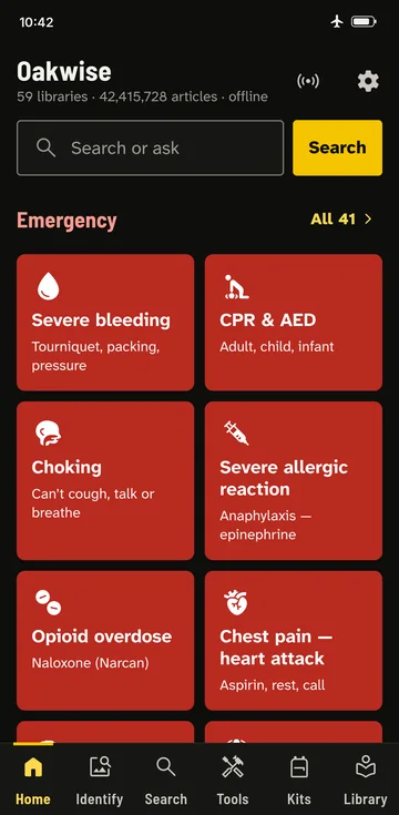
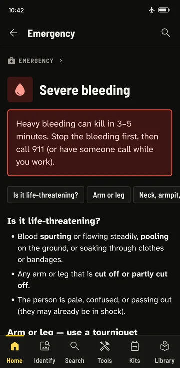
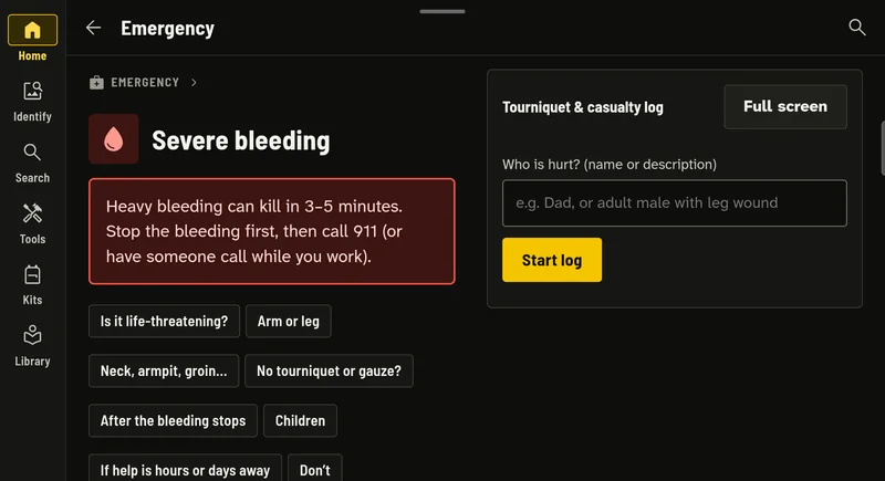
Severe bleeding, CPR, choking, overdose, stroke, burns and 35 more emergencies, never more than two taps from home. Every card starts with the most urgent step, in large type.
- The most urgent step first, then what to do if help is hours or days away.
- Jump to your situation: arm or leg, neck or groin, no tourniquet, children, and what not to do.
- Written from published guidelines, with the sources and the date each card was last checked.
Maps and routes, with no signal
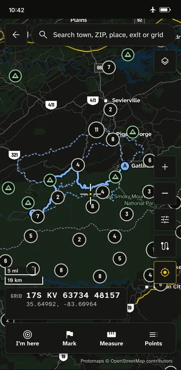
Street and trail maps for the states you choose, stored on your phone. Search towns, ZIP codes, exits, hospitals and water. Plan a route by car, on foot, by bike, on horseback, by ATV or by boat.
- Four ways to go. Alongside the main route, Oakwise finds an alternate, a contingency and an emergency route that keep off its roads where they can.
- Plans for bad days, not just traffic. Pick Normal, Disrupted, Breakdown or Collapse, and the route and its times change with it.
- Your position as a grid reference (MGRS and latitude and longitude), and a route card you can print or send as GPX, KML or a PDF.
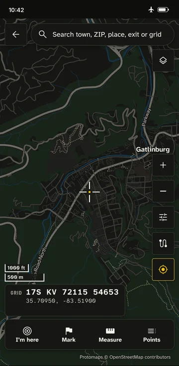
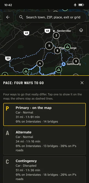
Great Smoky Mountains, Tennessee. Map data © OpenStreetMap contributors, via Protomaps.
Answers that show their work
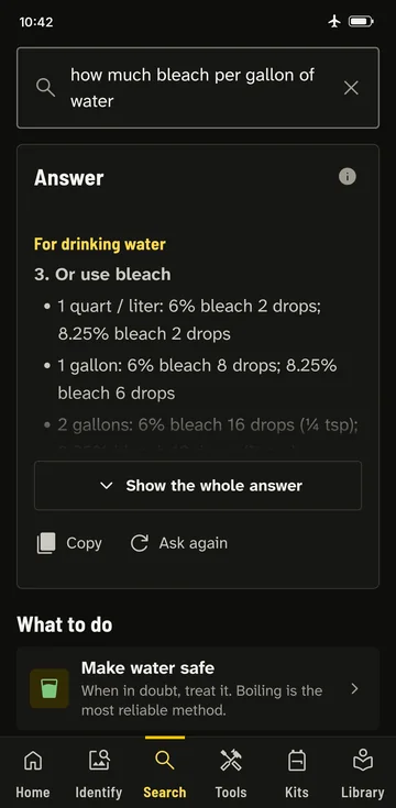
One search box for guides, tools, plant and animal photos, field manuals and the libraries you download. Life-safety answers come first, and every answer shows where it came from.
- Ask the way you’d ask a person: “how much bleach per gallon of water” finds the table in your guides.
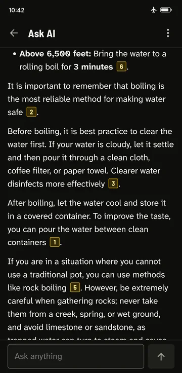
- Optional: Ask AI, a chat that answers from your whole library, with numbered links to its sources. Off until you turn it on, on devices that can run it.
- It runs on your device, so nothing you ask leaves it. On Android it’s a one-time download over Wi-Fi; on iPhone and iPad it uses Apple Intelligence where available.
Tools that need nothing but the phone
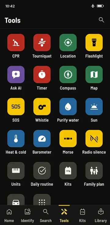
A CPR metronome, a tourniquet and casualty log, a flashlight and SOS strobe, a whistle and Morse code. A compass and barometer on phones that have the sensors, a water purification calculator, sunrise and sunset, timers, and kit lists with expiry reminders.
- Big targets and plain words, for hands that are cold, wet or shaking.
- A family emergency plan with contacts, meeting places and medicines that you can print.
Know what’s dangerous
Photo guides to venomous snakes and spiders, poisonous plants and mushrooms, and edible plants where you are, with look-alikes side by side.
- Where it lives, how to tell it apart, and the harmless species people mistake it for.
- If someone is bitten or stung, what to do now is at the top of the page.
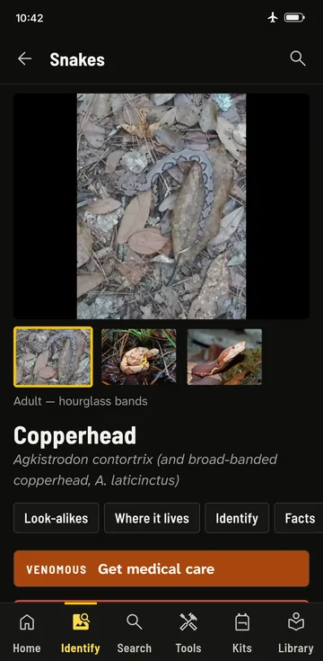
Photos in the screenshot: Andrew Durso and Alan Rockefeller (CC BY 4.0, iNaturalist), Holger Krisp (CC BY 3.0, Wikimedia Commons).
Your area, in all 50 states and DC
Tell Oakwise where you need maps and local information. You can change it any time.
- Around meYour location and a distance.
- Pick statesTap them on the map.
- Along a routeDraw it with your finger, for a trip or the drive home.
- Whole countryAll 50 states and DC.
Then choose what to download
- Maps Your area
- Streets, trails and place names, without signal.
- Route planning Your area
- The road and trail network the route planner works from.
- Local hazards and contacts Your area
- Your county’s top risks, weather radio stations and emergency offices.
- Plants and animals Your area
- Venomous snakes and spiders, and poisonous and edible plants where you are.
- Field manuals Everyone
- Government field manuals and classic woodcraft books.
- Reference libraries Everyone
- An offline medical encyclopedia, a general encyclopedia and how-to answers.
- Picked states
- States along the route
- Route
Before anything downloads, you see how much space your choices need next to the free space on your phone. Downloads wait for Wi-Fi unless you choose otherwise.
Sources and dates, in plain sight
Every guide lists the published guidelines it was written from and when it was last checked. Libraries show their edition date, so you always know how current your copy is.
- Is it life-threatening?
- Arm or leg: use a tourniquet
- Neck, armpit or groin: pack the wound
- No tourniquet or gauze?
Newer editions, on your terms
When you’re online, Oakwise checks for newer editions of what you have and gives you one notice, not a stream of alerts. For each item you choose:
- UpdateDownload the new edition, check it, then remove the old one.
- Skip this editionKeep what you have, and don’t ask again about that edition.
Or decide once: always replace, or always keep both while at least 2 GB stays free. Medical and safety updates are marked Recommended. Nothing on your phone is ever deleted remotely.
Made for big screens too
On a tablet or an iPad, Oakwise uses the room: the tool sits beside the steps, and the map’s panels open down the side instead of over it.
Buy once. No subscription.
No account to create, no ads, no upgrades to unlock. You get the whole app.
- No subscription, no in-app purchases and no ads.
- No account. Nothing to sign up for or sign in to.
- Your plan, kits and notes are kept on your device and in your own backups. We never see them.
- Share it with your household through Family Sharing on iPhone and iPad, and Family Library on Google Play.
Oakwise is a reference and training aid. It is not a medical device and does not diagnose, treat, cure, or prevent any medical condition. Always consult a healthcare professional for medical advice, diagnosis, or treatment. In an emergency, call 911 first if you can. Read the medical disclaimer